Exploring South District Hikes In Shenandoah National Park
 |
| The most remote area of Shenandoah National Park. |
The South District of Shenandoah National Park, often referred to as the park’s most remote area, offers a unique experience despite the presence of Skyline Drive, which cuts 44 miles through this part of the park. Along the route, you'll find developed areas like the Loft Mountain campgrounds, a camp store, and a picnic area at Dundo.
Located between the Swift Run Gap entrance station to the north and Rockfish Gap to the south, the South District stands out due to its larger proportion of federally designated wilderness areas compared to the park’s North and Central Districts. This designation ensures a more secluded, backcountry experience, ideal for those seeking solitude.
A few weeks ago, I made my way to the South District not necessarily for that remote experience, but because I had limited time to explore. I had two simple goals for this short trip: First, I wanted to enjoy breakfast with a view. Second, I hoped to hike a trail I hadn’t yet explored.
From Rockfish Gap to Jarman Gap, Skyline Drive runs through the narrowest section of the park, with the boundary of Shenandoah National Park just a few hundred feet from the road. This stretch of Skyline Drive was originally part of the Blue Ridge Parkway and was deeded to Shenandoah National Park in the early '60s. For a deeper understanding of this area, take a moment to read about the history of the Road to Nowhere to learn more about this section of the South District.
I entered the South District from the Rockfish Gap entrance station and headed north on Skyline Drive. My first stop was the parking area at Beagle Gap, located between mile markers 100 and 99 on Skyline Drive.
An interesting fact about this area: Bear Den Mountain, Little Calf Mountain, and Calf Mountain are not part of Shenandoah National Park, but rather fall within the boundaries of the Appalachian Trail Park. This section of land is included in the National Park Service’s inventory, adding an intriguing layer to the park’s diverse landscape.
 |
| The dodgeway is the gateway to start the hike into the meadow. |
 |
| Spicebush Swallowtail. |
 |
| Brewing up coffee on a Camping Gaz Turbo 270. |
 |
| Hiking back down the trail you are reminded that you are not hiking in SNP. |
Turk Mountain Trail is a blue-blazed side trail, offering an out-and-back hike of about 2 miles with 378 feet of elevation gain. From the parking lot, cross Skyline Drive to pick up the Appalachian Trail. Head south for a short 0.2 miles, then take the blue-blazed trail on your right to begin your hike.
 |
| Wildflowers line the trail. |
 |
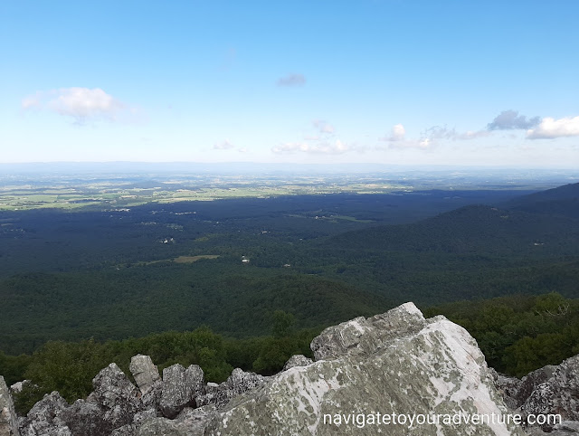
| The view from the summit of Turk Mountain. |
Although both hikes were relatively short, they gave me exactly what I was hoping for in the limited time I had. I was pleasantly surprised by what Turk Mountain Trail had to offer — from wildflowers to talus fields and stunning summit views.
Trail Notes:
- Activity: Day Hiking
- Route/Place: Appalachian Trail / Turk Mountain Trail
- Activity Type: Day Hiking
- Trail Difficulty Rating:
- Little Calf Mountain: Easy & Kid-Friendly
- Turk Mountain Trail: Easy to Moderate with a short rock scramble
- Trail Conditions: The Appalachian Trail is well-maintained, with clear signage and white blazes. Turk Mountain Trail is also well-maintained, featuring a section marked with Appalachian Trail white blazes before switching to blue blazes on the Turk Mountain Trail.
- Trip Results: Successful
- Road Conditions: Accessible for all vehicles — access fee required.


Comments