Rapidan Camp || Shenandoah National Park
On page 67 of my somewhat outdated guidebook, I discovered the perfect hike—a circuit trail around Hoover Camp. The route covered 9.9 miles with an estimated time of 5 hours. Perfect! Exactly what I had in mind.
When I arrived at Shenandoah National Park, I was greeted with perfect weather—61 degrees on the mountain, which was a welcome change from the recent heatwave. I began my hike at the Byrd Visitor Center, a great starting point for exploring the area. Both the Byrd Visitor Center and the Big Meadows area offer excellent access for day hikes. The Hoover Camp circuit begins on the east side of Skyline Drive, directly across from Big Meadows Wayside.
The trail starts on the Rapidan Fire Road, which is a gravel path cutting through Big Meadows. As a side note, you could easily spend an entire day exploring the network of trails in the meadow, a prime location for spotting deer and a variety of birds. About a mile down the Rapidan Fire Road, you'll find Mill Prong Spur Trail on your right. This trail will be my return route from Hoover Camp. I continued along the Rapidan Fire Road, descending into the Rapidan River Valley.
Note: If a 10-mile circuit sounds too long, there is a shorter option. You can take Mill Prong Spur Trail for 1.8 miles to Hoover Camp, making this hike an out-and-back route.
 |
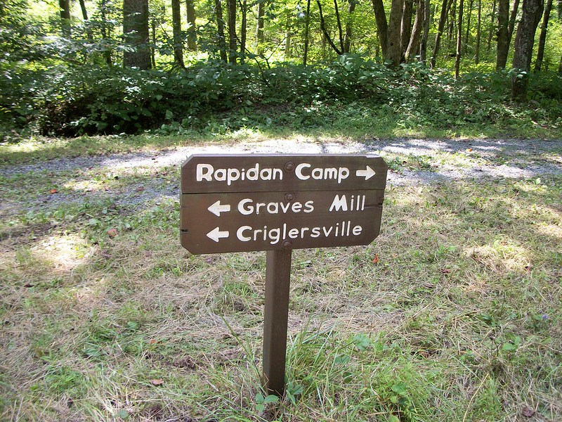
| The sign is correct and my map was outdated. |
I quickly checked my map and noticed both Rapidan Camp and Hoover Camp listed, which left me a bit confused. I knew I needed to head back up the mountain, but let me explain the mix-up—I'll keep it brief.
In 1948, the Boy Scouts of America were granted a 20-year lease on Rapidan Camp to use as a summer camp, and they renamed it "Hoover Camp." The resources I used to plan my hike were the 13th edition (1990) of the PATC Circuit Hikes in Shenandoah National Park guidebook and the 17th edition (1995) of PATC Map #10. Fast forward to 2004, after the National Park Service restored the campgrounds, they officially changed the name back to Rapidan Camp.
The 1995 PATC map had shown Rapidan Camp as the location used by the Marines, while Hoover Camp referred to the camp renamed by the Boy Scouts.
 |
| The road looks like it goes up forever! |
Just a short way up the fire road, I spot a trail marker indicating Rapidan Camp to the left. Following the side trail, I come across a cabin. At this point, I realize I’m probably about a mile east of where I thought I should be.
I double-check my map to see how far I need to go to reach Hoover Camp. Then, out of nowhere, a guy appears from around the cabin’s deck. I ask him if Hoover Camp is further up the trail, and he casually replies, "This is Hoover Camp."
Now I’m really confused. I thought I knew where I was on the map, but the signs were telling me something entirely different. That’s when the man explains that this is part of Rapidan Camp. He introduces himself as an NPS Volunteer, and he’s been volunteering as an interpreter at Hoover Camp for 9 seasons. As an interpreter, he guides park visitors around the camp, sharing its rich history.
Here's a link to the Park Service website about the camp. |
| The back view of "The Brown House." |
The NPS volunteer did a fantastic job leading the tour, providing fascinating insights into the history of the camp as well as the lives of President Hoover and First Lady Lou Henry Hoover. The guided tour took about an hour and was, without a doubt, one of the highlights of the hike.
After leaving Rapidan Camp, I followed Mill Prong Spur Trail back to Rapidan Road. From there, it was about a mile to the starting point.
While I did have a bit of confusion with the two camp names, this day hike turned out to be one of the most enjoyable I’ve experienced in the park.
Note: I didn’t follow the full route described in my guidebook. The hike took about 4.5 hours, covered approximately 9.3 miles (not including lunch or the tour), and involved an elevation gain of 1,320 feet.
Trail Notes:
Activity: Day Hiking
Route/Place: Rapidan Road, Broyles Gap, Mill Prong Trail, Mill Prong Spur Trail, Rapidan Road/Big Meadows
Activity Type: Day Hiking
Trail Difficulty:
- Rapidan Road: Easy
- Broyles Gap: Easy
- Mill Prong Trail: Easy
- Mill Prong Spur Trail: Easy
Trail Conditions: The trails are well-maintained and clearly marked with trail signs and white blazes.
Waterfalls/Streams: Big Rock Falls, Mill Prong, Laurel Prong, Rapidan River
Trip Results: Successful
Road Conditions: The road is suitable for all vehicles, with an access fee.


Comments